
Historical Treasure - Tracing Canal History By: Suzy Dunning
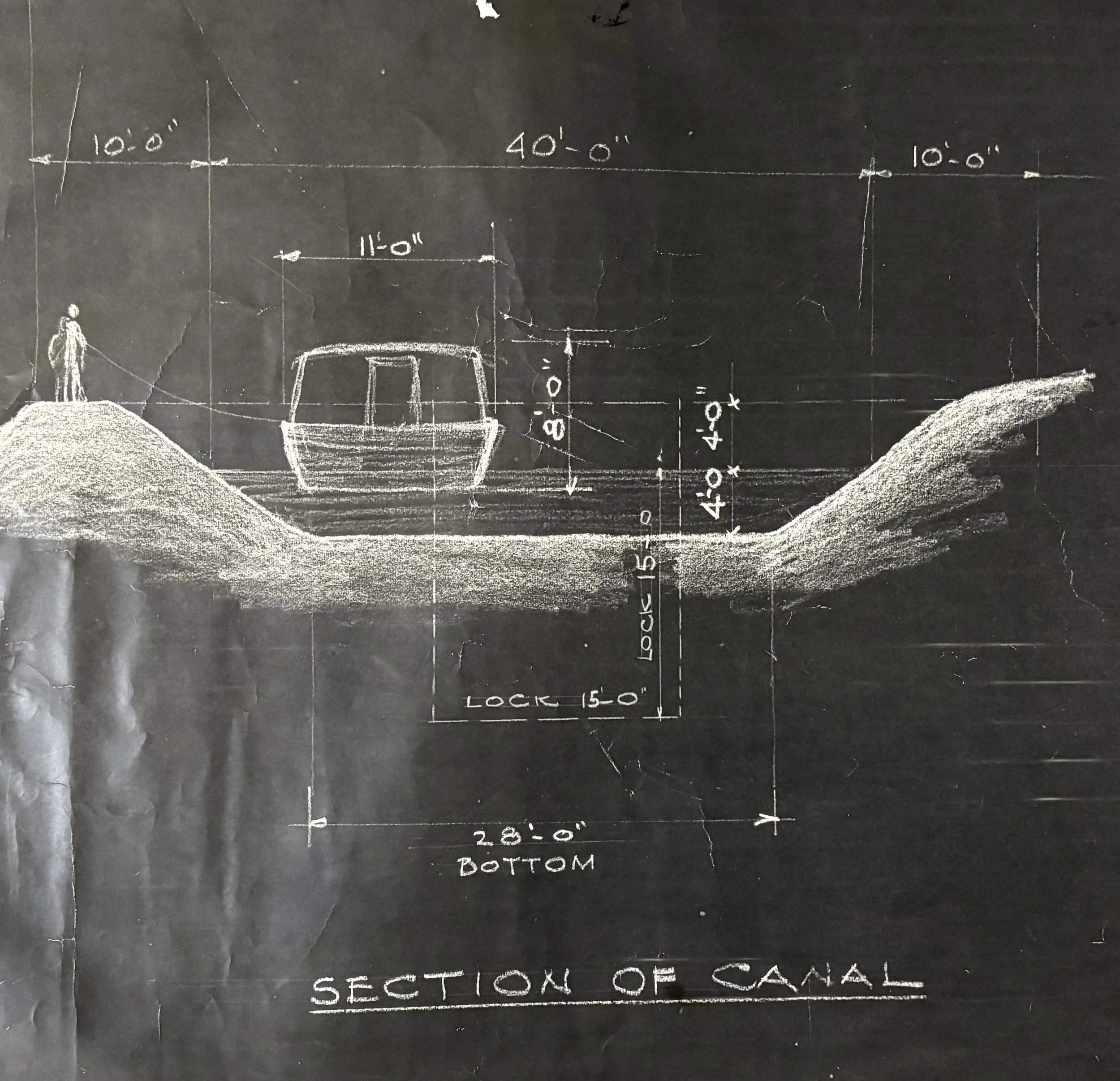
Sketched section of canal will be displayed in new exhibit at the Vigo County History Center
Every so often, a piece of history illuminates from the shadows of obscurity that lets us see the past with fresh eyes—like this recently found diagram of the Wabash and Erie Canal, once the engineering marvel that cut across Indiana. The diagram was discovered in the archives of the Vigo County History Center but has no attached identifying information as to where it came from or who created it. After consulting with a few friends at the Canal Society of Indiana it’s believed to have likely come from the canal headquarters which were in Terre Haute.
The diagram displays the obvious skill of someone with drafting and artistic ability. The precise measurements and layout of the canal features indicate the creator would have been knowledgeable about aspects of the canal’s engineering. With accurate dimensions the print illustrates a cross section of a working canal. The width of the canal at water level is shown as 40 feet across and the depth from the bank to the bottom of the water was 8 feet. The canal was constructed in this way to ensure the water remained at a consistent depth of 4 feet. The sketch is printed in white lines on a black thin paper that resembles blueprint paper. Further research into the type of paper may reveal more of the story of this mystery print.
In preparation of a new upcoming display in the Special Exhibit Gallery at the Vigo County History Center the research team is taking a deep dive into local canal history. The Wabash and Erie Canal was a man-made waterway built in the 1800s to connect the Great Lakes to the Ohio River. Terre Haute was an important stop along the canal when it reached the city around 1849. Before the railroad came, the canal made it possible for farmers and businesses in Vigo County to ship goods like grain, pork, and lumber easily. It was a smoother ride and a more affordable method than shipping by wagon. The canal boats were pulled by mules or horses walking along a towpath beside the water. In Terre Haute the canal was eventually abandoned, and railways became the new means for moving goods. Although the canal can no longer be seen in Vigo County, its path shaped the growth of the city. Today, street names and local landmarks such as Riley lock No. 47 still remind us of a time when the Wabash and Erie Canal promised to open Indiana to the wider world.